There could be some severe weather on the way for parts of the Prairies Monday evening and into Tuesday morning.
Environment Canada has issued a severe thunderstorm watch for a large area from just east of Calgary to just west of Saskatoon.
“Conditions are lining up for more storms later this afternoon and into the early evening hours, with the main concerns being strong wind gusts, large hail and heavy rain,” said Global Calgary meteorologist, Tiffany Lizée.
“There is also the small possibility we could see a landspout tornado form.”
Unlike supercell tornadoes, which start at the clouds and extend down to the ground, landspout tornadoes form near the ground and spin upwards to connect with the clouds, explained Lizée.
Landspouts are also “typically weak and short-lived,” added Lizée, whereas supercell tornadoes are much more powerful, destructive and have longer duration.
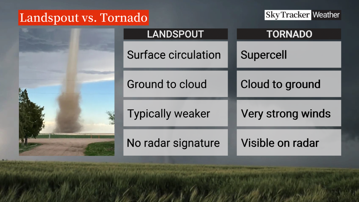
Landspout tornadoes are “typically weak and short lived,” whereas supercell tornadoes are normally much more powerful, destructive and longer lasting.
Global News
There is also the possibility of more severe weather northwest of Calgary, where there’s a heavy rainfall warning in place stretching north through Jasper National Park and east, almost to Drayton Valley.
“Rainfall totals could reach 70 mm by Tuesday morning,” said Lizée. “While most of the rain fell throughout the day, showers will linger through tonight and into tomorrow morning.”
There’s also a severe thunderstorm warning in place for western Saskatchewan.
The warning from Environment Canada said there is a line of storms that is developing in Montana that’s expected to move north into the province Monday evening, generating strong wind gusts.
“Damage to roofs, fences and trees is possible,” warns Environment Canada, adding that “fast-moving and rapidly rising water can also sweep vehicles away and damage infrastructure.”
