The long-range forecast for B.C.’s South Coast looks dry, but it won’t necessarily be sunny — with an inversion likely to develop in the region.
A persistent high pressure ridge is settling in over the South Coast, which typically would mean sunshine, especially in the summer. But in the fall and winter months that’s not always the case.
Read more:
Photos: Fog blankets parts of B.C.’s South Coast
During the cooler, wetter months this type of high pressure ridge can create a thick layer of fog or low cloud, which can engulf the city in grey, cool conditions for many days.
The sun is there, it’s just higher up above the cloud — but depending on how thick the layer of fog or cloud is, you may not see it.
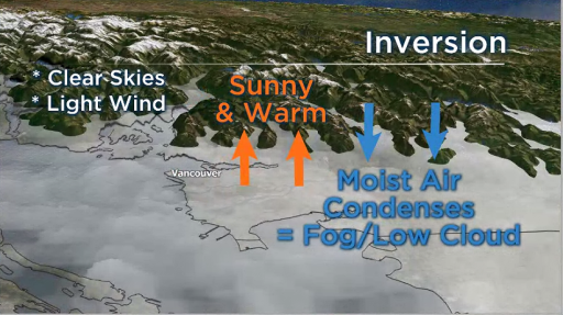
Under clear skies and light wind, radiation fog and an inversion can develop.
Global BC
The best place to be under these types of conditions is on the mountain. When an inversion develops, this is where you will find the sunshine, warmth and the most amazing views of the city covered in a soft blanket of cloud.
However, the weather system also comes with a warning from Avalanche Canada. They are concerned many people will be heading to the mountains, and with warmer temperatures to above 3,000 metres there is an increase risk of avalanches.
The following regions are under an avalanche warning effective through to the end of Monday: North and South Columbias, Purcells, Kootenay Boundary, and Glacier, Banff, Yoho, and Kootenay National Parks.
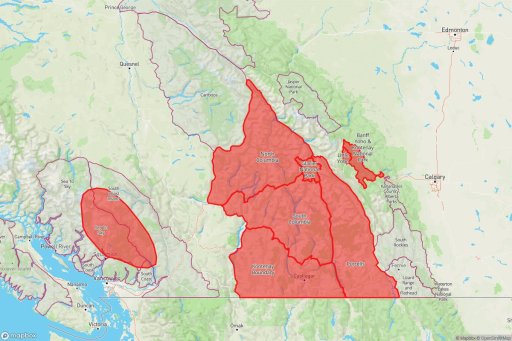
An avalanche warning has been issued by Avalanche Canada
Avalanche Canada
“It also applies to an area within the Sea-to-Sky and South Coast Inland regions, from Squamish to Pemberton,” according to Avalanche Canada.
How high-pressure ridges can generate cloud and fog
Upper-level ridges during the winter initially cause clear skies, just like they does in the summer. Weather systems that would typically move onto the coast are diverted north, protecting the South Coast.
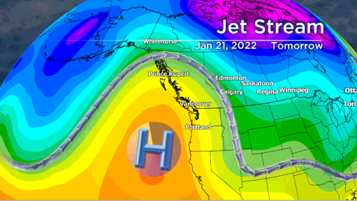
A persistent upper level ridge will remain over the South Coast for several days
Global BC
However, due to light winds and clear skies, the ground loses a lot of heat, or longwave radiation, in the winter at night.
As the air near the surface cools, the moisture in the air the reaches saturation and creates a layer of low level cloud or fog. This is called radiation fog.
During this process an inversion develops. The air near the ground becomes cooler than the air above.
Sometimes the sun can warm up the cloud layer or fog enough during the day it causes the cloud droplets to evaporate. This can give the city a little relief from the cloudy, cool conditions but it doesn’t last long, the fog typically redevelops at night.
Smog can also be a problem during inversions. The pollution gets trapped near the surface by the warm inversion layer above. If the inversion persists for several days and air quality advisory may be issued.
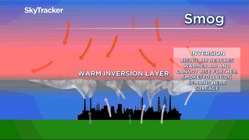
Warm inversions layers can trap smog near the surface
Global BC